Minnesota Vacation: Eagle Mountain
 |
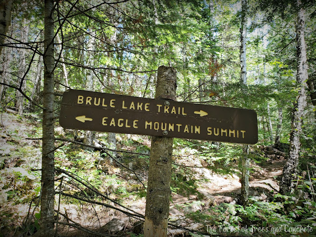
| This trail sign divides the trail for those who want to scale the peak and those who don't. |
Happy Sunday! I'm on my third cup of coffee, contemplating my fourth, and ready to share my next vacation post with you. On our second day in Minnesota, we made our way to the highest point in Minnesota: Eagle Mountain. Eagle Mountain was the reason we were in Minnesota in the first place, and I was eager and ready to hit the trail.
We prepared for the hike by dressing head-to-toe in clothes and spraying ourselves (and our clothes) with 40% Deet bug spray. Minnesota mosquitos are legendary and so you have to dress and protect yourself accordingly. Since the weather is much cooler this far north, even in July, hiking in full coverage isn't a bad thing. Although, we still dressed in layers because hiking is an activity that can really make you sweat, even in cooler weather - I sweat just as easily hiking in the winter - so being able to take off and put on layers is incredibly helpful.
This is the map at the trailhead, and I've circled our route in pink. The sign I showed in the first picture marks where the trail snakes off to the left at Whale Lake. The yellow line on the map denotes where the Boundary Waters Canoe Area Wilderness (BWCAW) is, and a picture I have a bit farther down shows where it begins on the trail.
Not far into the trail, I snapped this picture. As you can see, the forest is dense and butts right up to the trail. While it looks pretty, it's virtually impossible to get any real views around you because of it.
This picture really showcases the stark reality of this trail. It's rocky and also covered in tree roots in many areas. It makes the miles you hike more arduous and take longer to cover. Where I can normally do a hiking mile in roughly 20 minutes, it took Dad and I a good 40 minutes on this trail.
As I mentioned above, this is where the trail becomes one with the BWCAW. As you can see, it's part of Superior National Forest. I am a bit of a nerd when it comes to National Parks and National Forests, so it brought a smile to my face. It also brought back memories of our hike up the highest point in South Dakota, Black Elk Peak. It lies within the Black Elk National Forest and I snapped a picture of that sign as well.
Incidentally, this hike up Eagle Mountain came exactly one year to the day that we climbed up Black Elk Peak. Highpointer for life!
It was nice to reach Whale Lake and finally get an expanded view and one that wasn't just dense forest as well. Don't get me wrong, I love the forest but it's nice to have some pretty views when you're on a long hike.
Here you can see the combination of rocks and tree roots covering the trail. It's neat to look at, but brutal to hike on for extended periods of time.
I snapped this picture of my hiking partner, my dad, as we began the last mile to the summit. The last mile deviates from the mostly flat (yet rocky) trail by being a nearly straight up trail through a boulder field. This last mile took my dad and me an hour to negotiate.
About halfway up the summit trail, we were treated to our first bit of clearing which allowed us to finally get a glimpse of the landscape around us.
This plaque marks the highest point in the state and sits back amongst some trees in the dense forest. It was a bit underwhelming, I will admit.
After we reached the actual summit, we went back down a few hundred feet to the one vista this mountain has. It was nice to finally have a real mountain view, and below you can see a handful of lakes: Zoo Lake, Shrine Lake, and Eagle Lake. You can see more lakes in the distance. While that might seem crazy to be surrounded by so many lakes, it is Minnesota after all and they don't call it the Land of 10,000 Lakes for nothing!
Another shot from the same vantage point, only to the left. The trail is a bit farther to the left just out of sight. I loved how that lone little cloud in the sky seemed to just hover above the forest.
As Dad and I started our descent back down the boulder field, I remarked that I would never hike this trail again on purpose. I mean, I'm stoked that I hiked it because hiking up the state high points is a goal for me, but this trail sucked. Between having not much in the way of views and constantly walking on rocks and tree roots, it wasn't a fun hike. The trail was hard and brutal going, and I felt it after we got back to the motel. We saw a handful of people sitting on rocks off to the side during our ascent and descent up the boulder field. I could just tell by their bodies and the looks in their eyes that they were completely exhausted, and I sympathized with them. Even I was over and done with it by the last mile. Thank Odin my dad was there to coax me through it!
I'll be posting another vacation post this week, and, trust me, this one was much more fun - even if there wasn't that huge sense of accomplishment that comes with climbing a mountain! Have a great rest of your weekend.


Comments